 Out Of The Blue Artifacts A Library of a lifetime of collecting
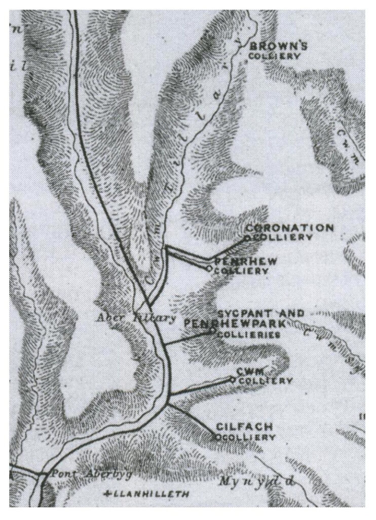
Tyr Nicholas Cwmtillery Colliery – Brown’s Colliery 1843.
The Tyr Nicholas Colliery, Cwmtillery was also known as Browns Colliery in the early days after its owner Mr Thomas Brown.
A section of Mr John Prujean’s map of the Collieries and Levels of North Monmouthshire printed in 1843. It shows a few old levels in the Abertillery area – Gilfach Level, Cwm Level (Cwm Farm area), the Sycpant and Penrhew Parc Levels, Penrhew and Coronation Levels (the Green Meadow area) and can be seen at the top of the map is Brown’s Colliery, Cwmtillery Colliery, a year after it was sunk.