Abertillery & District Coal Levels

Mr Matthew Habakkuk – Colliery Owner, Agent and Mining Engineer

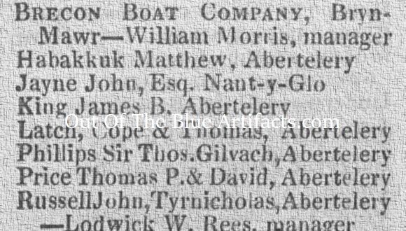
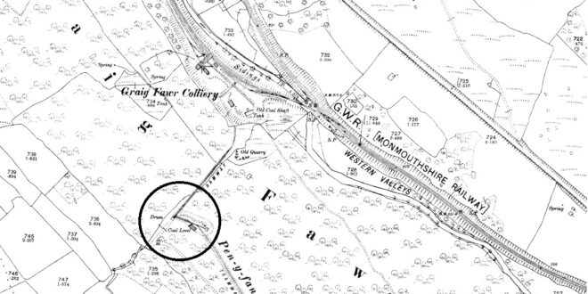
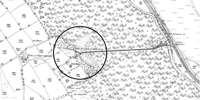
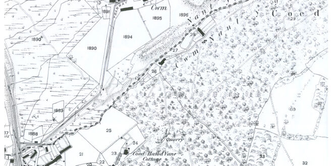
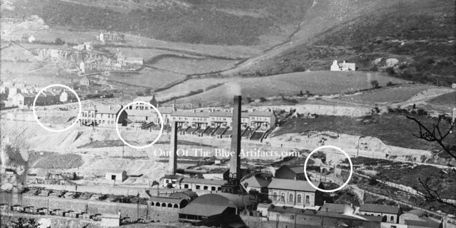
Mr Matthew Habakkuk – Colliery Owner, Agent and Mining Engineer. Mr Matthew Habakkuk was born in the 1790’s at Langyfelach, Glamorgan. Some documents have him with differing age. I believe he married a Margaret (no information) she was from the same town Langyfelach, Glamorgan and was born in 1800. An advertisement from the Monmouthshire Merlin newspaper (as seen left) dated …

Read More »

Graig Fawr Colliery and Level

Graig Fawr Colliery and Level. The map shows the Graig Fawr Level (circled top) and the Graig Fawr Colliery (circled bottom) with the Marine Colliery in the middle of the two. (Information to come)

Read More »

Llandavel Colliery Cwm Valley

The Llandavel Colliery Cwm Valley. The Llandavel Colliery was a coal level and was mentioned in a report from April 1865 and being owned by Mr John Russell. The Village. The workman’s cottages at Llandavel, Cwm were built about 1873. The Monmouthshire & Cwm Collieries Co. In 1880 the Llandavel Colliery was listed as being owned by the Monmouthshire & …

Read More »

New Penyvan Level.

New Penyvan Level. In the late 1880’s the new Penyvan Level was established, it was on the same side of the mountain just south of the Graig Fawr Colliery near Llandafal Village, Cwm. The tramway from this new Penyvan Level came down into the Graig Fawr Colliery and was connected by a surface tramway to the old Penyvan Colliery towards …

Read More »

Old Penyvan Colliery

Penyvan Colliery. One of the earliest known collieries in the district, it was situated on the mountain slightly north west of the Aberbeeg Colliery with its tramway coming down towards the River Ebbw Fawr (as seen on the map). The Penyvan Coal Company. In the early 1800’s the Penyvan Coal Company had established the colliery and installed the tramway to …

Read More »

Cwm Nant-y-Groes Level

Cwm Nant-y-Groes Coal Level. Situated up in the Cwmnant-y Groes area of Six Bells, the colliery is featured on the 1843 map of the coalfield as being in production and had a tramway to the main tram road at Six Bells. Messrs T. P. & D. Price. The coal level was opened by Messrs T. P. & D. Price. Mr …

Read More »

Cwm Farm Levels

Cwm Farm Level. There were a few coal levels in the Cwm Farm area though I haven’t got any pin-point exact locations only maps with very few details. The featured photograph shows (circled) the areas of the three known levels on the map. The area was owned by the Cwm Estate, hence the names, Cwm Farm, Cwm Cottage Road, Cwm …

Read More »

Cwm Farm Levels

The Cwm Farm Levels. The 1880 map shows the same area as the photograph detailing approximately the locations of the three coal level entrances.

Read More »

Six Bells Balance Pit

Six Bells Balance Pit. This water balance pit (circled on the map) was situated between the River Ebbw and the railway lines opposite where Six Bells Colliery would later sited. I cannot find details of the colliery but will keep searching. The image shows the Balance Pit (far right) after it closed. (Information to come).

Read More »
error: Content is protected !!