Colliery Aerial Ropeways

A Section of the Cwmtillery Colliery Flight Rope

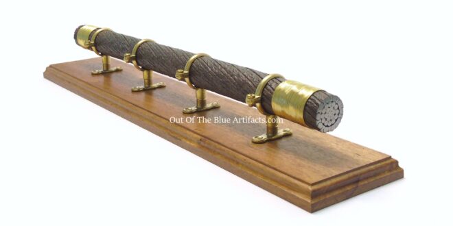
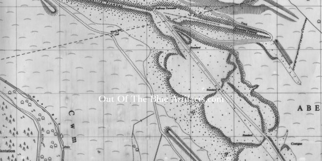
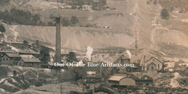
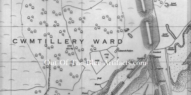
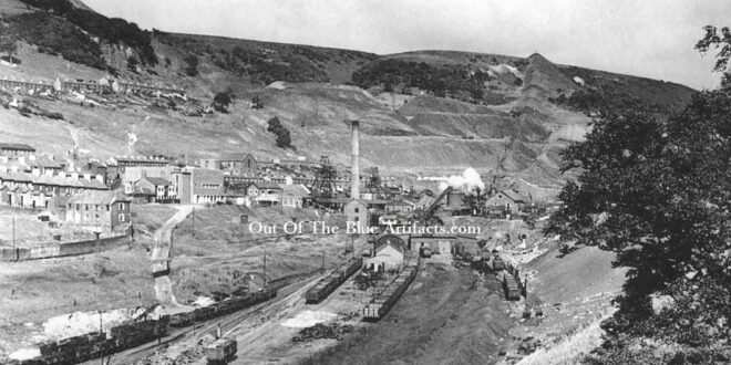
A Section of the Cwmtillery Colliery Flight Rope. This section of flight, aerial ropeway steel rope was found on-site at Cwmtillery Colliery. It is a half-lock coil, burden rope, this was the rope the flight buckets would travel upon while being pulled by the haulage rope.  The section of rope is 20″ inches in length by  1 and a 1/4″ …

Read More »

Six Bells Colliery – Old Waste Tip

Six Bells Colliery – Old Waste Tip. The Six Bells Colliery site was built close to the waste tips from the Durban Level which was situated up on the mountain just below where the television transmitter is today. The Durban Level owned by T. P. Price was tipping their waste on the grounds opposite the old Six Bells Inn where …

Read More »

Six Bells Colliery Aerial Ropeway – Lower Section and Colliery Washery

Six Bells Colliery Aerial Ropeway – Lower Section and Colliery Washery. The map shows the lower section of the aerial ropeway and filling station situated between the river and sidings. The route of the aerial ropeway can be seen going between the Arael School and houses on Aberbeeg Road at Warm Turn. In December 1924 great concern of falling buckets …

Read More »

Six Bells Colliery Aerial Ropeway – Mid Section

Six Bells Colliery Aerial Ropeway – Mid Section. The map shows the mid-section of the aerial ropeway. The ropeway is seen emerging from the bottom right to the top left. Arael Farm (bottom left) can be seen. The John Lancaster Company is documented as the tenants of the farm and Arael Farm Coal Level in the 1910-1920’s, the company must …

Read More »

Six Bells Colliery Aerial Ropeway – Upper Section and New Waste Tip

Six Bells Colliery Aerial Ropeway – Upper Section and New Waste Tip. The map shows the upper section of the colliery aerial ropeway and waste tip on the Arael Mountain at Cefn Bach. The ropeway is seen emerging from the bottom right up to the summit and spread along the area via tramlines laid down on the site. Just north …

Read More »

Cwmtillery Colliery Aerial Ropeway – Original Tip

Cwmtillery Colliery Aerial Ropeway – Original Tip. The old photograph shows the original aerial ropeway and tip spreading up the mountain from the Cwmtillery Colliery.   Points of interest – The large flat tip seen (behind the chimney) was from the Llanerch Padern Coal Level which can be seen (far right). Originally there were tramlines leading from the level to …

Read More »

Cwmtillery Colliery Aerial Ropeway – Mid Section

Cwmtillery Colliery Aerial Ropeway – Mid Section. The map shows the mid-section of the old route. The standards on the old route were later dismantled when the ropeway was turned, the new waste tip was started in the late 1920’s. The waste was tipped at various places en route resulting in the valley being covered in waste from the collieries …

Read More »

Cwmtillery Colliery Aerial Ropeway – Old and New Tips

Cwmtillery Colliery Aerial Ropeway – Old and New Tips. The photograph shows the new tip (far left) dominating the sky line and the old original tip (far right) in the distance. The new tipping route had been gradually building up from the older image.

Read More »

Cwmtillery Colliery Aerial Ropeway – Lower and New Section

Cwmtillery Colliery Aerial Ropeway – Lower and New Section. The map shows the section from the colliery (bottom right) up the original route north westerly and showing the dog-leg left up to the new tip (far left). The buckets took the waste to the top of the mountain and the waste was then transported to the top of the tip …

Read More »
error: Content is protected !!