 Out Of The Blue Artifacts A Library of a lifetime of collecting
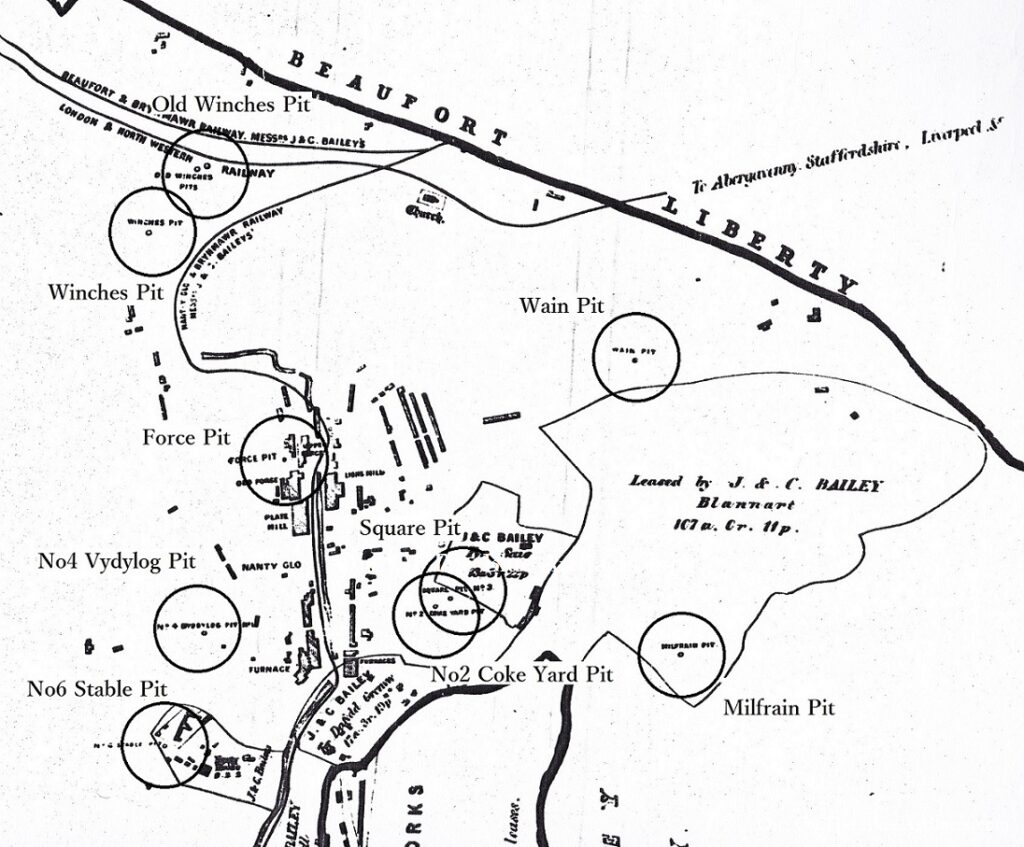
Nantyglo Collieries.
A portion of Messrs J. & C. Bailey land map showing their Nantyglo Ironworks in the 1870s, The map features some of the collieries (circled clockwise bottom to top) – No6 Stable Pit in the grounds of the round houses; No4 Vydylog Pit; The Force-Forge? Pit; Winches Pit; The Old Winches Pit; The Wain Pit; Milfrain Pit; No2 Coke Yard Pit and the Square Pit:
The three rows of houses in the centre of the image were the Limestone Houses. Also the Nantyglo House bottom left.