 Out Of The Blue Artifacts A Library of a lifetime of collecting
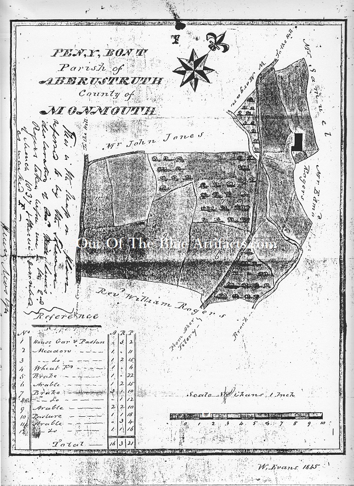
Penybont 1835.
The map features the land area upon which the Penybont Tillery Colliery was sunk. Messrs T. P. Price and his brother D. Price started the sinking of the colliery in about 1846. The shafts were sunk and completed by November 1850.
Mr Matthew Habakkuk was the underground surveyor and engineer in charge.
Some features on the map – Top right “Road to the Hill” is the Crook Hill area, just below is Penybont Farm, the farm is now buried directly beneath Henley’s Bus Depot. This farm can be seen on an old image of the colliery and the out-buildings must have been constructed around the farm.
The road and Tilery Brook are entwined and just left of the farmhouse was a stone bridge, that original stone bridge gave its name to the area “Pen-y-bont”
Far left can be seen the road leading to “The Hill” Cwmtillery west with the turn off to what is now Wallace’s Lane.
Penybont Land.
During a court case in August 1864 in regard to “Stothert and Another v Samuel”, which heard a case against ownership of the land at Penybont, stated that in 1814 various deeds showed that in 1814, the properties of Tyr-y-dyffryn and Greenmeadow were devolved upon Mr Daniel Samuel.
In May 1831, Mr Samuel conveyed to Mr Thomas Brown. In December 1840 Mr Thomas Brown mortgaged to Mr Daniel Samuel.
In July 1842 Mr Daniel Samuel and Mr Thomas Brown conveyed to Messrs John Brook Hythe, Samuel Macaulay Crutwell and George Shaw. In February 1843, Hythe, Crutwell and Shaw paid off the mortgage and Mr Daniel Samuel conveyed to them.
In 1846, Shaw and Crutwell granted a lease of the land to Mr Thomas Prothero Price for coalmines only for forty-two years. Others who were mentioned in the property case were – Messrs Frederick Levick, Robert Crutwelland Mr Henry Stothert.