 Out Of The Blue Artifacts A Library of a lifetime of collecting
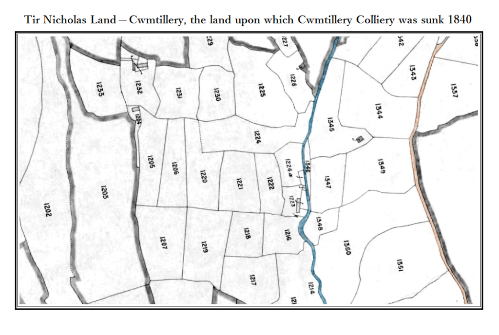
Tyr-Nicholas Land.
This is a section of the 1840 tithe map showing the area of land known as Tyr-Nicholas, the land upon which Mr Thomas Brown of the Cwmcelyn and Blaina Iron Company established Tyr Nicholas Colliery, Cwmtillery Colliery. Sinking started in about 1840 and in September 1842 the elled coal seam was struck. The shaft was 130 yards deep by 7′ feet in diameter.
At this time there were a fair amount of people living in the Cwmtillery valley working the many individual coal levels and on the 1841 census there were also many sinkers.
Sinkers Living in Cwmtillery in 1841.
A list of the sinkers and colliers registered – Mr James Williams; Mr Martin Bonds; Mr William Bennett; Mr John Adams; Mr Thomas Williams; Mr Robert Burnell; Mr Francis Adams; Mr Jobe Samuel; Mr William Esau; Mr William Plackman; Mr Solomon Whitcom; Mr Nimrod Whitcom; Mr Richard Briant?; Mr Charles Sanders and Mr Henry Thomas:
Points of Interest – The map is aligned north – south (top – bottom) with the River Tyleri Tillery running to the right (coloured blue). Ty-Nicholas Farm (seen center right) on the riverbank. Mr Thomas Brown purchased Ty-Nicholas to build the colliery, he later purchased more land in order to enlarge and extend the colliery surface buildings.
Top left can be seen Ty Doctor and the cottages on Pant-y-Darren, West Side. On the 13th of February 1913 these cottages were destroyed in a landslip.
At the time of this map there was no lake or reservoir, the lake was man made and was constructed as a colliery feeder sometime between the 1840’s and 1880. The reservoir was constructed in the late 1890’s by Mr Noel Bagley, contractor of Oak Street, Abertillery.