 Out Of The Blue Artifacts A Library of a lifetime of collecting
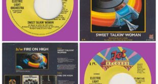
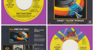
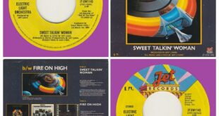
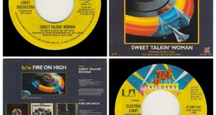
A Side……. Sweet Talkin’ Woman B Side……. Fire On High Label/No……. Jet JT-WX1145 Pressed in ……. USA Notes……. Purple vinyl. Small UA logo on both labels and publisher’s credits on the lower right labels. Miss-pressing centre hole off-set. Intro timing printed on label.
Read More »SWEET TALKIN’ WOMAN/FIRE ON HIGH…….USA