Abertillery & District Coal Levels

Gilfach Level

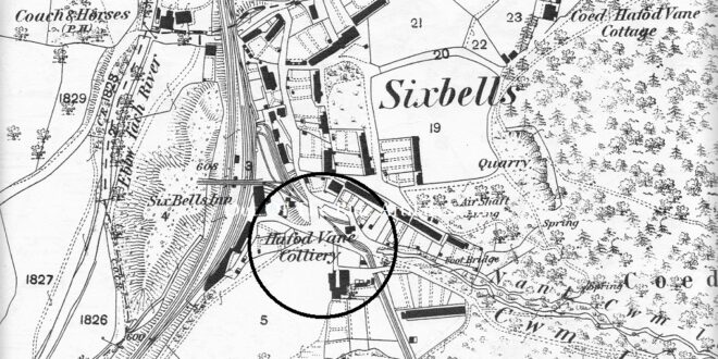
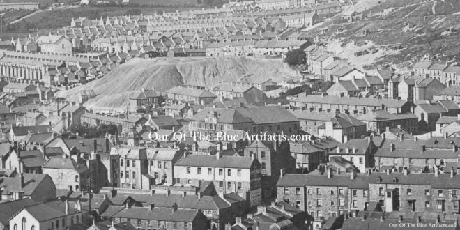
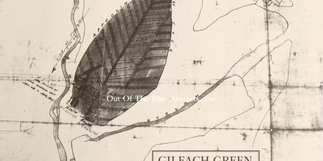
Gilfach Level. This coal level was more than probably originally worked for the Gilfach Farm personal use. The colliery was later featured on the 1843 map of the coalfield as being in production and has a tramway to the main railway in Six Bells. In 1908 it was listed as being owned by Mr E. Davies of Gilfach Farm, Six …

Read More »

Hafod Van Level

Hafod Van Level. This coal level was situated close to the railway on where Browns Corner is today. It was one of the oldest levels in Six Bells and was supposedly owned by Mr Thomas Phillips Price in 1869, as with the Durban Level, I don’t know if it was Messrs T. P. Price as in Thomas Protheroe Price? (More …

Read More »

Craig-yr-Aral Level & The Gas Works Level

Craig-yr-Aral Level. This coal level was situated close to the top end where Arrail Street is today, it may have been connected with the nearby Pant-yr-Aral Farm. The farm was demolished when the houses on Arrail Street was constructed. The Pant-yr-Aral Farm was located where numbers 4, 6 and 8 Upper Arrail Street is today. In 1849 it was reported …

Read More »

Arael Farm Level

Arael Farm Level. This small-scale coal level was situated on the top of the Arael Mountain slightly north of the Arael Farm (as seen circled on the map above). In 1908 it was listed as being owned by the farmer Mr Edward Nicholas & Son and employed just one man. Mr Edward Nicholas was a farmer from Ynysduu who had …

Read More »

Arrail Level

Arrail Level. This coal level was situated on the western side of the valley (as seen circled on the map) between Aberbeeg and Six Bells. Messrs Latch and Cope. In 1863 the partnership of Messrs Latch and Cope leased a portion of land in the Six Bells valley from Messrs Capel Hanbury Leigh and opened the Arrail Colliery. On early …

Read More »

Sycpant Rhiw Parc – Rhiw Park Levels

Sycpant Rhiw Parc – Rhiw Park Levels. These are two of the oldest coal levels in the Abertillery area. The image shows the Rhiw Park waste tip in the center of the image and the town buildings and houses built around it. The Sycpant. The Sycphant Coal Level was more than probably owned by Mr Francis Adams. Mr Adams was …

Read More »

West Blaina Red Ash Level

West Blaina Red Ash Level. This coal level was situated on the side of the Arael Mountain above West Side Blaina, close to the Llanerch-y-Pant Farm. Mr R. C. Banks. The West Blaina Red Ash Level was opened in 1887 by Mr R. C. Banks. The tramway incline came from the level entrance down the mountain passing close to Alma …

Read More »

Coed Cae Tillery Coal Levels

Coed Cae Tillery Coal Levels. These coal levels were situated on the western side of Mynydd James mountain on the eastern side of the valley overlooking Rose Heyworth Colliery, they are some of the oldest coal workings in the area. They were numbered 1 and 2. Mr Matthew Habakkuk. Opened in the 1850’s by Mr Matthew Habakkuk, on land leased …

Read More »

Coed Cae Tillery Coal Levels

Coed Cae Tillery Coal Levels. The image shows the Coed Cae Tillery Levels and waste tip (top of the photograph). The tramway from the levels came down the “Ginney” and on down to the main tram line and coke ovens close to where the Rose Heyworth Millennium School is today.   Points of interest – The image shows the Rose …

Read More »

Gilfach Green Level

Gilfach Green Farm. Gilfach Green Level was originally part of the Gilfach Green Farm, now called Blaentillery Farm, which in the mid 19th century was said to have been the Hunting Lodge of Crawshay Bailey. At this time the original farm was higher up in the valley and called Blaen-Tilerau. When the Bailey family moved from the Hunting Lodge the …

Read More »
error: Content is protected !!