 Out Of The Blue Artifacts A Library of a lifetime of collecting
Blaina Nantyglo Collieries. Just a few of the collieries in the area. Ffosmaen Colliery, the Old Sun Pit, Trostre Pits and the Coalbrookvale Colliery. The name Trostre is spelt in many different ways on maps over the years.
Read More »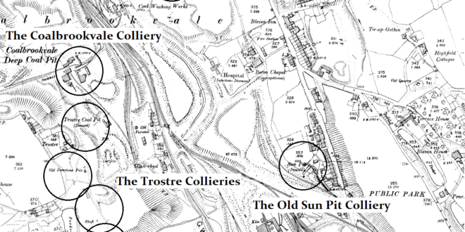
Blaina Nantyglo Collieries. Just a few of the collieries in the area. Ffosmaen Colliery, the Old Sun Pit, Trostre Pits and the Coalbrookvale Colliery. The name Trostre is spelt in many different ways on maps over the years.
Read More »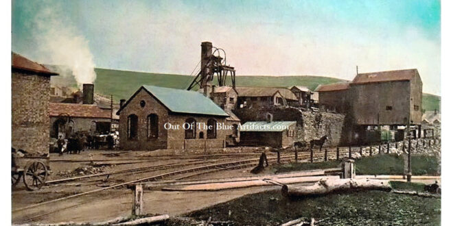
The Sun Pits – North Blaina Colliery – Stones Pit. There was an old disused shaft on the site prior to 1880 more than probably opened and owned by Messrs Bailey Bros and the mothballed. Sometime later the Messrs Stone Brothers, Mr John & William Stone took over and renamed it the “New Sun Pit” It was mentioned in reports …
Read More »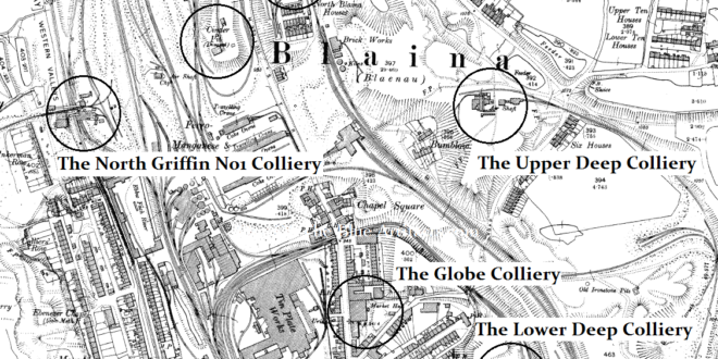
The Stones Colliery. (Information on another page). The Upper Deep Colliery. Opened in about 1855, the Upper Deep Colliery was located in the Cwmcelyn area and may have been opened by Messrs Levick & Simpson. In 1864 a coal cutter was invented by Levick and Jones of Cwmcelyn and exhibited in the Paris Exhibition. Mr James Brown and his brother …
Read More »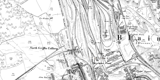
North Griffin Colliery – Bailey’s Pit, Blaina. The Griffin Colliery was locally known as Bailey’s Pit and was along with all the deep mines in the area originally a water balance pit. The colliery was situated just north of Inkerman Row, West Side, Blaina. The colliery is shown on the section of the Messrs J. & C. Bailey brothers sales …
Read More »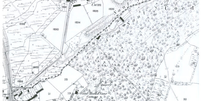
Cwm Nant-y-Groes Coal Level. Situated up in the Cwmnant-y Groes area of Six Bells, the colliery is featured on the 1843 map of the coalfield as being in production and had a tramway to the main tram road at Six Bells. Messrs T. P. & D. Price. The coal level was opened by Messrs T. P. & D. Price. Mr …
Read More »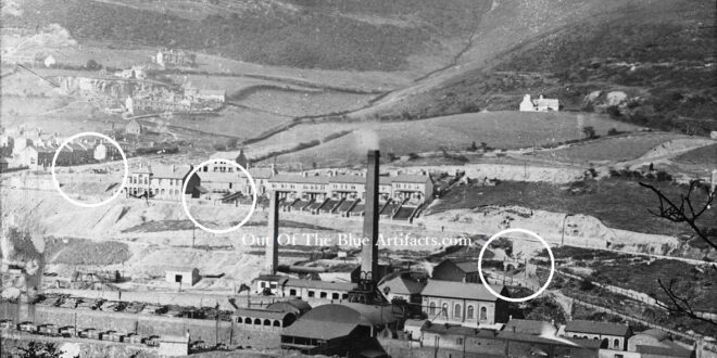
Cwm Farm Level. There were a few coal levels in the Cwm Farm area though I haven’t got any pin-point exact locations only maps with very few details. The featured photograph shows (circled) the areas of the three known levels on the map. The area was owned by the Cwm Estate, hence the names, Cwm Farm, Cwm Cottage Road, Cwm …
Read More »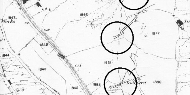
The Cwm Farm Levels. The 1880 map shows the same area as the photograph detailing approximately the locations of the three coal level entrances.
Read More »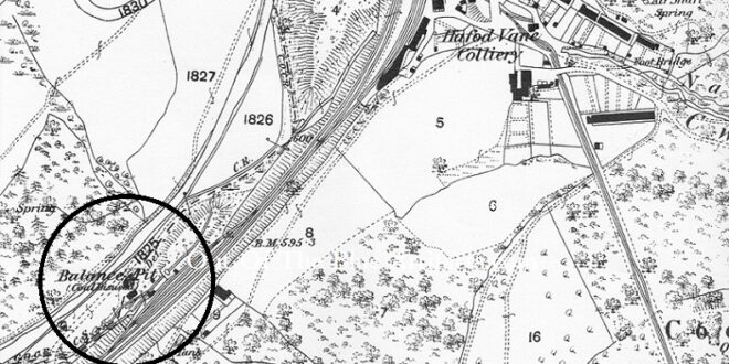
Six Bells Balance Pit. This water balance pit (circled on the map) was situated between the River Ebbw and the railway lines opposite where Six Bells Colliery would later sited. I cannot find details of the colliery but will keep searching. The image shows the Balance Pit (far right) after it closed. (Information to come).
Read More »Gilfach Level. This coal level was more than probably originally worked for the Gilfach Farm personal use. The colliery was later featured on the 1843 map of the coalfield as being in production and has a tramway to the main railway in Six Bells. In 1908 it was listed as being owned by Mr E. Davies of Gilfach Farm, Six …
Read More »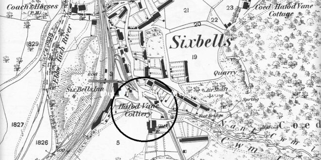
Hafod Van Level. This coal level was situated close to the railway on where Browns Corner is today. It was one of the oldest levels in Six Bells and was supposedly owned by Mr Thomas Phillips Price in 1869, as with the Durban Level, I don’t know if it was Messrs T. P. Price as in Thomas Protheroe Price? (More …
Read More »