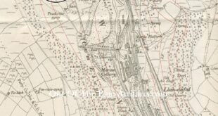
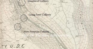
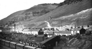
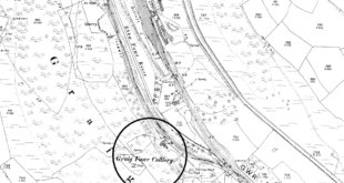
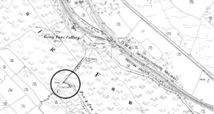
Graig Fawr Colliery and Level. The map shows the Graig Fawr Level (circled top) and the Graig Fawr Colliery (circled bottom) with the Marine Colliery in the middle of the two. (Information to come)
Read More »History of the Gwent Collieries
Cwm Valley Collieries
Cwm Valley Collieries.
Read More »Llandavel Colliery Cwm Valley
The Llandavel Colliery Cwm Valley. The Llandavel Colliery was a coal level and was mentioned in a report from April 1865 and being owned by Mr John Russell. The Village. The workman’s cottages at Llandavel, Cwm were built about 1873. The Monmouthshire & Cwm Collieries Co. In 1880 the Llandavel Colliery was listed as being owned by the Monmouthshire & …
Read More »Graig Fawr Colliery
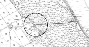
Graig Fawr Colliery. The Graig Fawr Colliery was located on the western side of the Cwm Valley (as seen circled on the map) just south of Llandaval Village. The Graig Fawr Colliery was not marked on the 1880 maps and only appeared on the 1901 ordnance survey maps, so must have been sunk between those years. On the 1880 maps …
Read More »New Penyvan Level.
New Penyvan Level. In the late 1880’s the new Penyvan Level was established, it was on the same side of the mountain just south of the Graig Fawr Colliery near Llandafal Village, Cwm. The tramway from this new Penyvan Level came down into the Graig Fawr Colliery and was connected by a surface tramway to the old Penyvan Colliery towards …
Read More »Old Penyvan Colliery
Penyvan Colliery. One of the earliest known collieries in the district, it was situated on the mountain slightly north west of the Aberbeeg Colliery with its tramway coming down towards the River Ebbw Fawr (as seen on the map). The Penyvan Coal Company. In the early 1800’s the Penyvan Coal Company had established the colliery and installed the tramway to …
Read More »Nantyglo Collieries
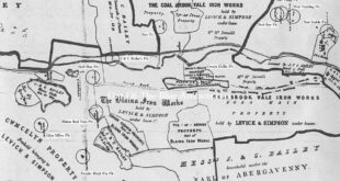
Nantyglo Collieries. A portion of Messrs J. & C. Bailey land map showing their Nantyglo Ironworks in the 1870s, The map features some of the collieries (circled clockwise bottom to top) – No6 Stable Pit in the grounds of the round houses; No4 Vydylog Pit; The Force-Forge? Pit; Winches Pit; The Old Winches Pit; The Wain Pit; Milfrain Pit; No2 …
Read More »Blaina and Nantyglo Collieries and Iron Works
J. & C. Bailey land map mid 1800s. A small portion of a J. & C. Bailey land map mid 1800s showing land leases and just a few of the many collieries. The map features the collieries circled left to right – Glyn Milwr Pit; The Feeder Black Pin Pit; Blaina Red Vein Pit; No8 Flue Pit; J & C …
Read More »North Blaina Collieries
The North Blaina Collieries. Ffosmaen Colliery. (Information to come) Peggy’s Pit Coalbrookvale Nantyglo. There isn’t a great deal known about this colliery, though it was a deep mine with quite a few men employed there. It was situated close to the Ffosmaen Colliery and on the image can be seen both collieries and an airshaft (top right of the image). …
Read More »Coalbrookvale Colliery
Coalbrookvale. The name of Coalbrookvale was an English derivation of Nant-y-glo, stream of coal, Coal Brook in the vale of. Mr George Brewer. The Coalbrookvale Iron Works were set up in the 1820’s by Mr George Brewer. Later his son Mr Thomas Llewellyn Brewer took control. Coalbrookvale Colliery. The Coalbrookvale Deep Pit was sunk sometime after 1840, (the colliery was …
Read More » Out Of The Blue Artifacts A Library of a lifetime of collecting
